


About Us
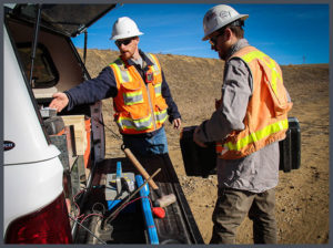 Steve started Ascent Geomatics Solutions (Ascent) in May, 2006 in response to clients requests in the D-J Basin for faster and more accurate surveys and stakings needed for Well Location Certificates. Steve rented 2 offices at 240 Union in Lakewood, CO. He hired a receptionist and a PLS, purchased a used 1996 Ford 150 pickup and a Pentax Total station. The PLS and an associate would collect the data for 1-2 vertical wells a day, load the data into DocMall and the Well Location Certificate was prepared for the client. As oil prices increased, Ascent hired more surveyors and purchased more trucks and equipment.
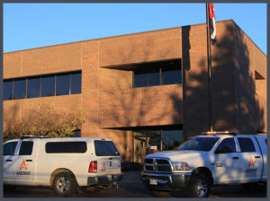 As the demand grew and sites became more complicated in 2007, Steve recognized the need to assist clients with the design of the drill pad site and access roads so he added Civil Engineers to the team. In 2008, Steve added a Regulatory and Permitting team to assist clients in putting together the information needed for the Colorado Oil and Gas Commission to issue a Drilling Permit. By the end of 2008, the team had grown to 14, so he purchased a building at 1801 W 13th Avenue in Denver to accommodate more growth. During this period, directional or horizontal drilling became more economical, and clients were now requesting surveys and stakings for multiple wells from a single pad, which greatly increased the complexity of the projects. In response, Steve purchased more complicated total stations and data collectors and added members to the surveying, civil engineering and permitting teams. He also created a GIS department to systematically store all of the data collected and created a hosted website called Petroleum Asset Manager (PAM) so that our clients could access all of their data on-line. He also opened an office in Rifle, CO to accommodate the needs of client operators on the western slope.
 In 2011, to serve the needs of clients’ requests in the Williston basin, Steve opened an office in Williston, ND and began to expand our services to midstream providers.
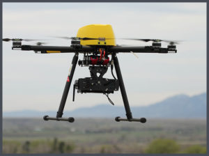
Although the precipitous decline in oil prices in 2014 interrupted 10 years of double digit growth and expansion of services, it gave us an opportunity to look at new technologies, new services and new industries. Clients are requesting more geospatial data, want it collected faster and more economically. In response to these requests, we are now using drones, or UAVs and LIDAR scanners. We can now analyze and manage this data with sophisticated software that allows our clients to make more timely and accurate business systems. We are now offering these services to other industries such as mining and infrastructure challenges. To reflect these changes, Petroleum Field Services is changing its name to Ascent Geomatics Solutions effective January 1, 2017.
While the technologies have grown in scope and expense, our goal is still to give the same high quality service to all of our clients.


 Bio coming soon.
 Hold for Lisa McCool bio.
 Hold for Christie Petersen bio.
 Scott Bass manages all Colorado survey crews at Ascent. He began at Ascent in 2019, and has a variety of skills, including GPS and Conventional field survey locations, AutoCAD Drafting, Revit drafting, Bid Package Preparations, Directing Operations, Business Development, Project Budgeting, and Deed Research/Analysis.
 Hold for Matt Morris bio.
 Chief People Officer
 Ramsey joined the Ascent team in November of 2017 and is CFO, as well as overseeing the Accounting, Finance, IT and Operations functions of Ascent. Ramsey brings more than a decade of finance experience across multiple disciplines including budgeting, FP&A, M&A, controllership, pricing and contract negotiations and treasury management.
 Founder
 Chief Executive Officer
 Regulatory Manager
 Director of Innovation
 Chief Operating Officer
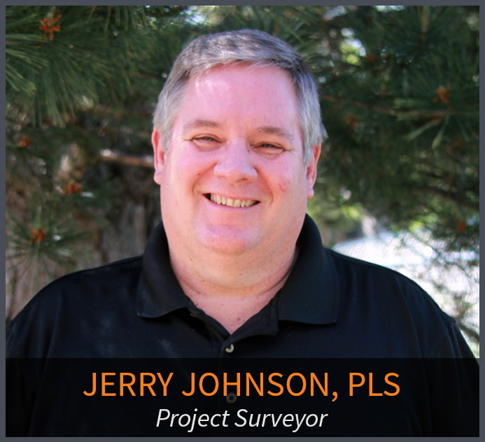 Jerry has more than 30 years of technical and project management experience in the field of land surveying. As a retired Colorado Department of Transportation (CDOT) employee of 30 years, he brings his knowledge of CDOT procedure and techniques to the team. He is involved in the day to day process, procedures, and workflows of the infrastructure related projects, project phase and tasks, and verifying the delivery of survey data for the infrastructure projects. Primary functions include the QA/QC of daily and final survey deliverables, project management, researching Right of Way records, ensuring Federal, State, County, and Local requirements are met, and the signing and sealing of survey related documents for recording. Jerry has been a licensed Professional Land Surveyor in Colorado since 1994.
 Program Manager
 Bob has more than 40 years of experience in the surveying and mapping professions. He has worked in the capacity of owner, survey manager, office manager, and project manager for surveying, construction and engineering firms. As a Professional Land Surveyor, he has experience working on survey projects involving Primary control layout, construction, boundary, mining, oil-gas, topographic, and design. He has provided these services to a variety of clients including CDOT, Arapahoe County, Jefferson County, Clear Creek County, City and County of Denver, private engineering firms including CH2M Hill, Carter Burgess, J.F. Sato, Merrick & Co, Washington Group, Nolte Associate, and construction companies including Johnson Brothers Construction, Ames Construction Co., Sema Construction Co., KiewitWestern Construction, Kelly Construction and Lawrence Construction Co. Bob has been a Licensed Professional Land Surveyor since 1983, and holds an Associate Degree in Surveying from Red Rocks Community College.
 Productions Manager
 Engineering Manager
 GIS Manager
 Senior Field Coordinator/Crew Chief
 Colorado
 Data Processing Specialist
 Controller
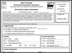 Upstream oil & gas operators have one simple goal: find and drill hydrocarbons. To do this, operators must navigate the regulatory gauntlet to receive their necessary permits. Without the proper expertise and experience, operators can lose valuable time and possibly even lose the location itself to another operator.
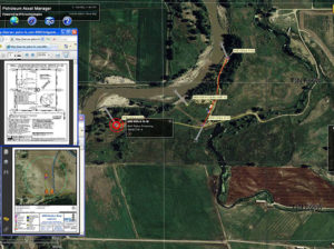 Extended Text for Popup: The ability to manage all your assets is critical to running an efficient organization. Having the ability to view floodplain, wildlife and/or utility lines can help operators better plan their sites for Surface Use Agreements (SUA).
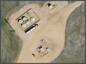 Viewing up-to-date aerial imagery can help save companies thousands of dollars by avoiding previously unforeseen challenges at the site location.
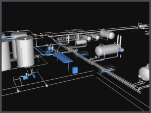 Most oil & gas operators will create as-built drawings for their well pads, pipelines, facilities and any other construction related projects. ASCENT has completed thousands of as-built surveys and drawings for our clients. Our extensive experience has taught us the most efficient and cost effective ways to create these as-built deliverables.
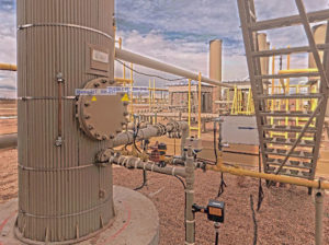 When companies are looking to design, or modify a facility, there is no reason not to use LiDAR technology. LiDAR provides design-grade accuracy with 3D modeling to see how the facility will look after construction.
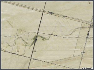 Pipeline projects can cost millions of dollars. Missing the project timelines can cost midstream operators even more money. That is why planning on the front-end of the project is so important.
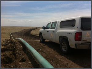 Longer pipeline corridors can take a significant amount of time to create topographic surveys with traditional methods. With aerial LiDAR, ASCENT can significantly reduce the time it takes to create these topographic surveys while providing a tremendous amount of useful data. This highly accurate pre-construction LiDAR data can then be married with highly accurate after-built LiDAR data to determine the precision of the planned and constructed pipeline.

